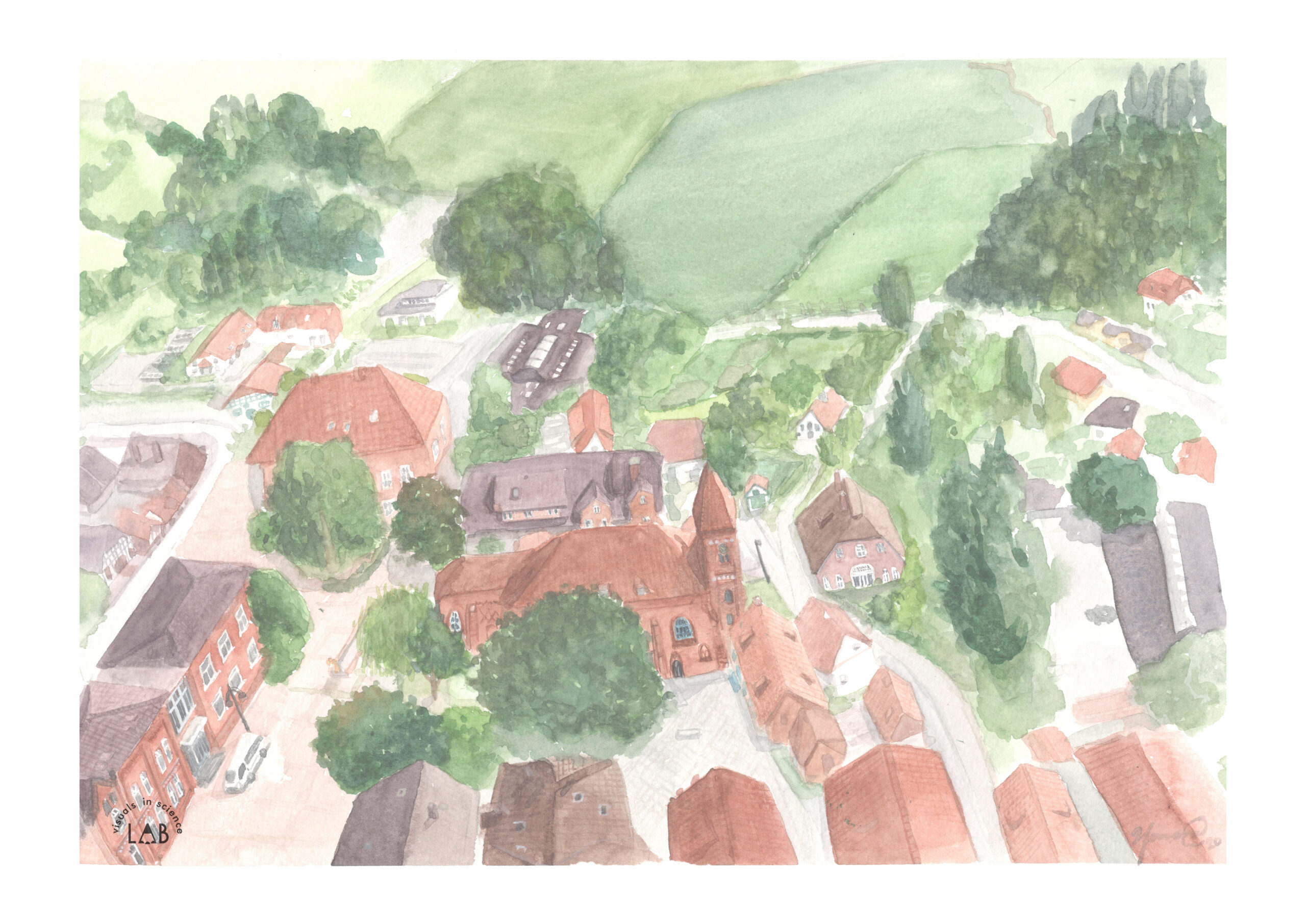
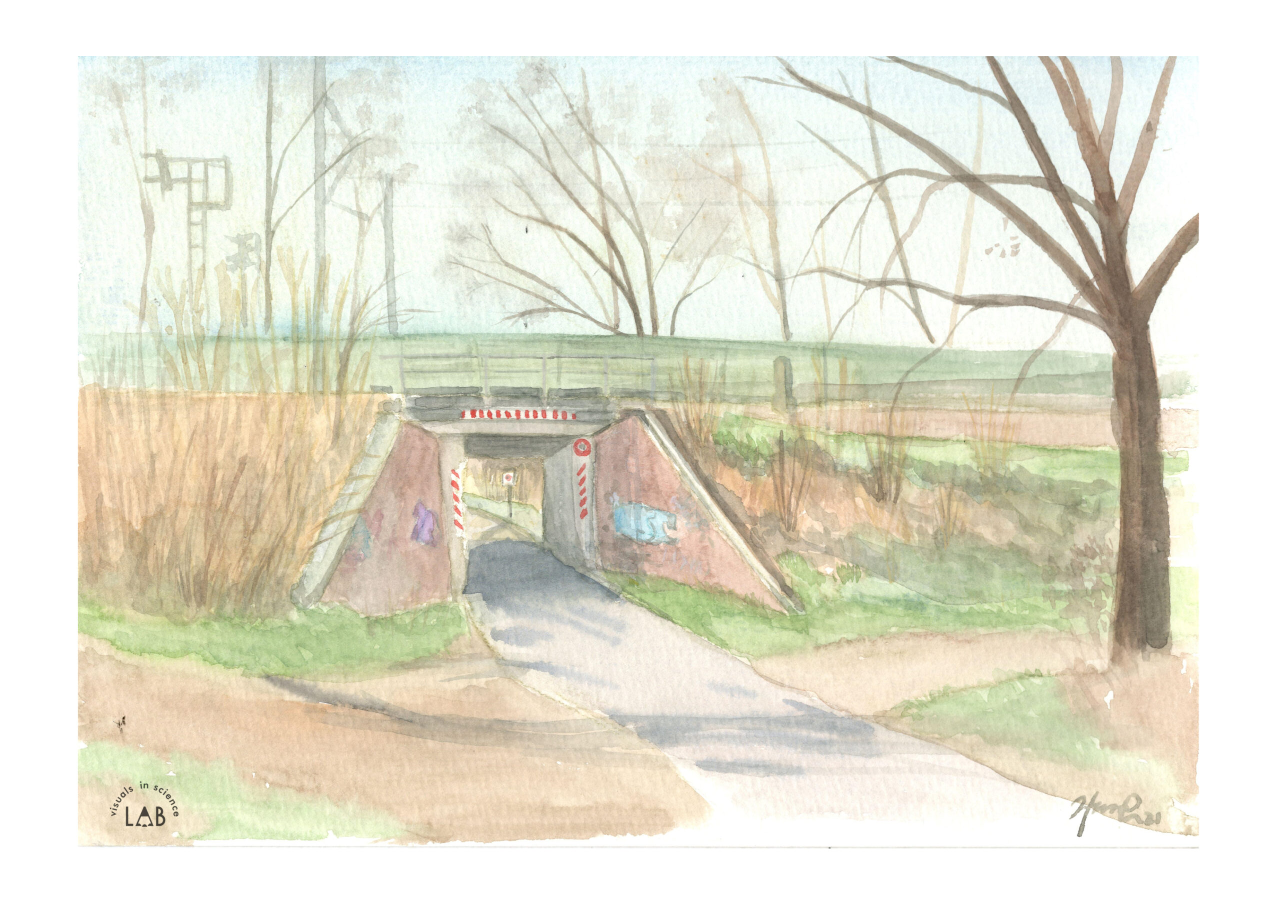
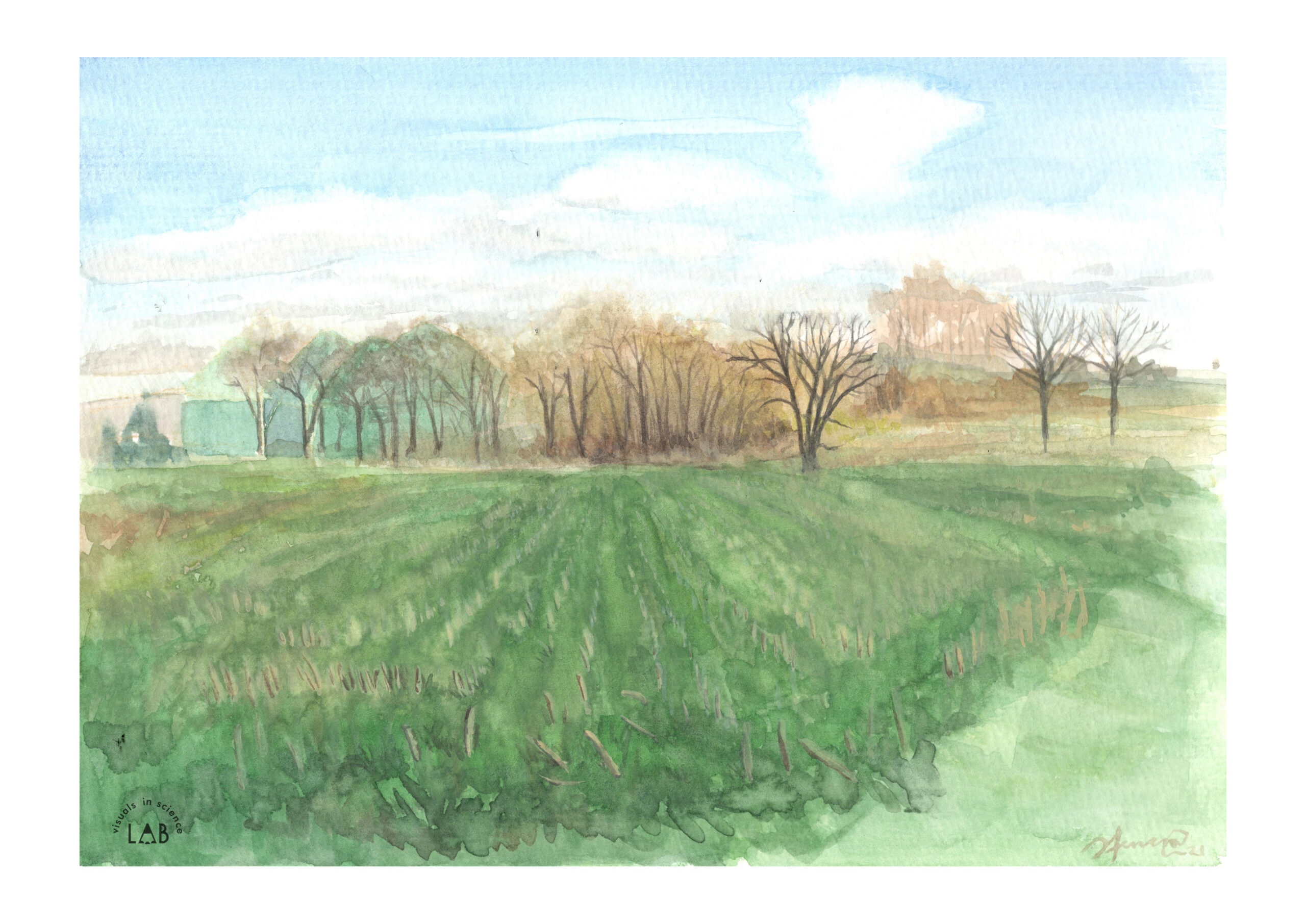
Before
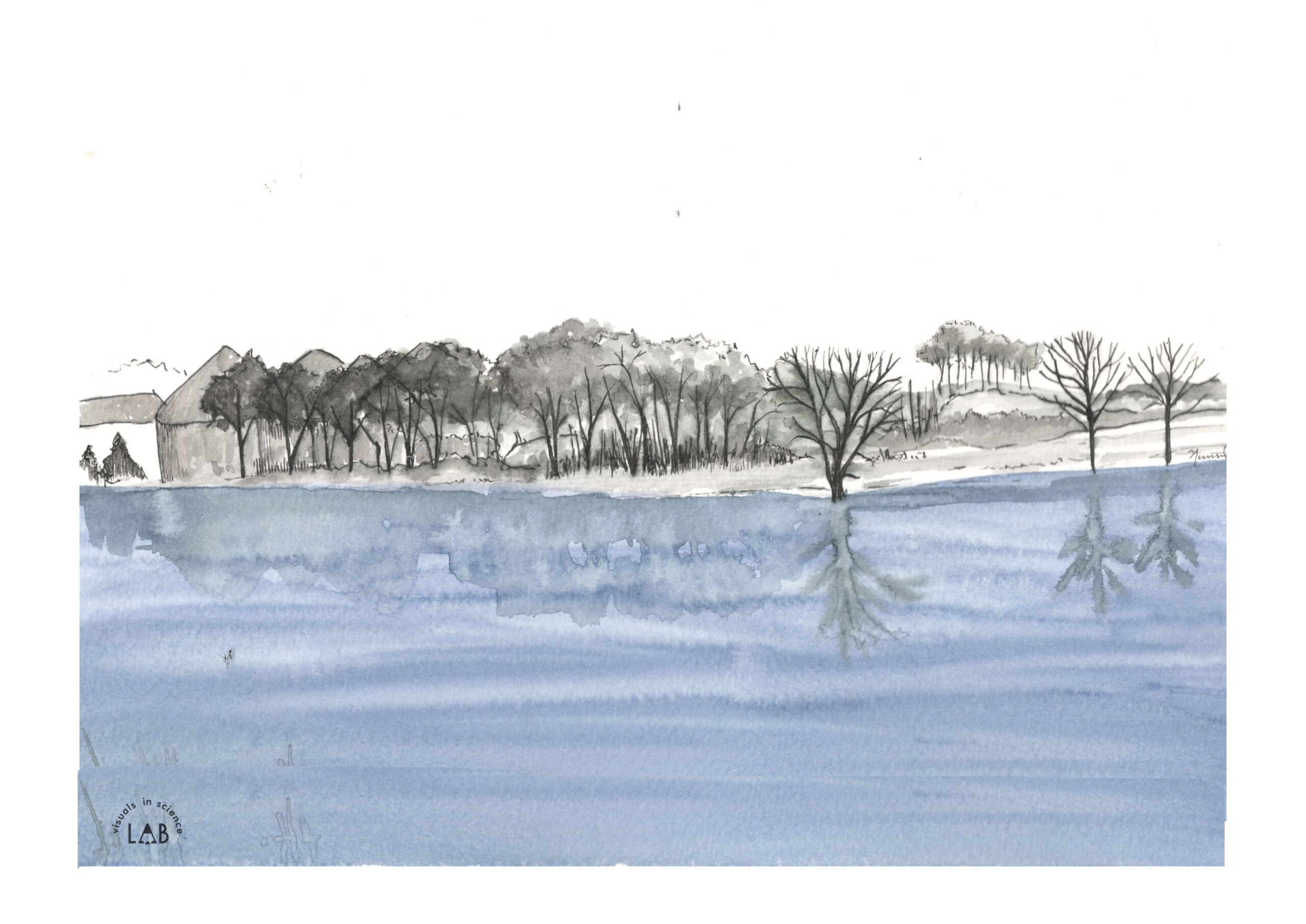
After
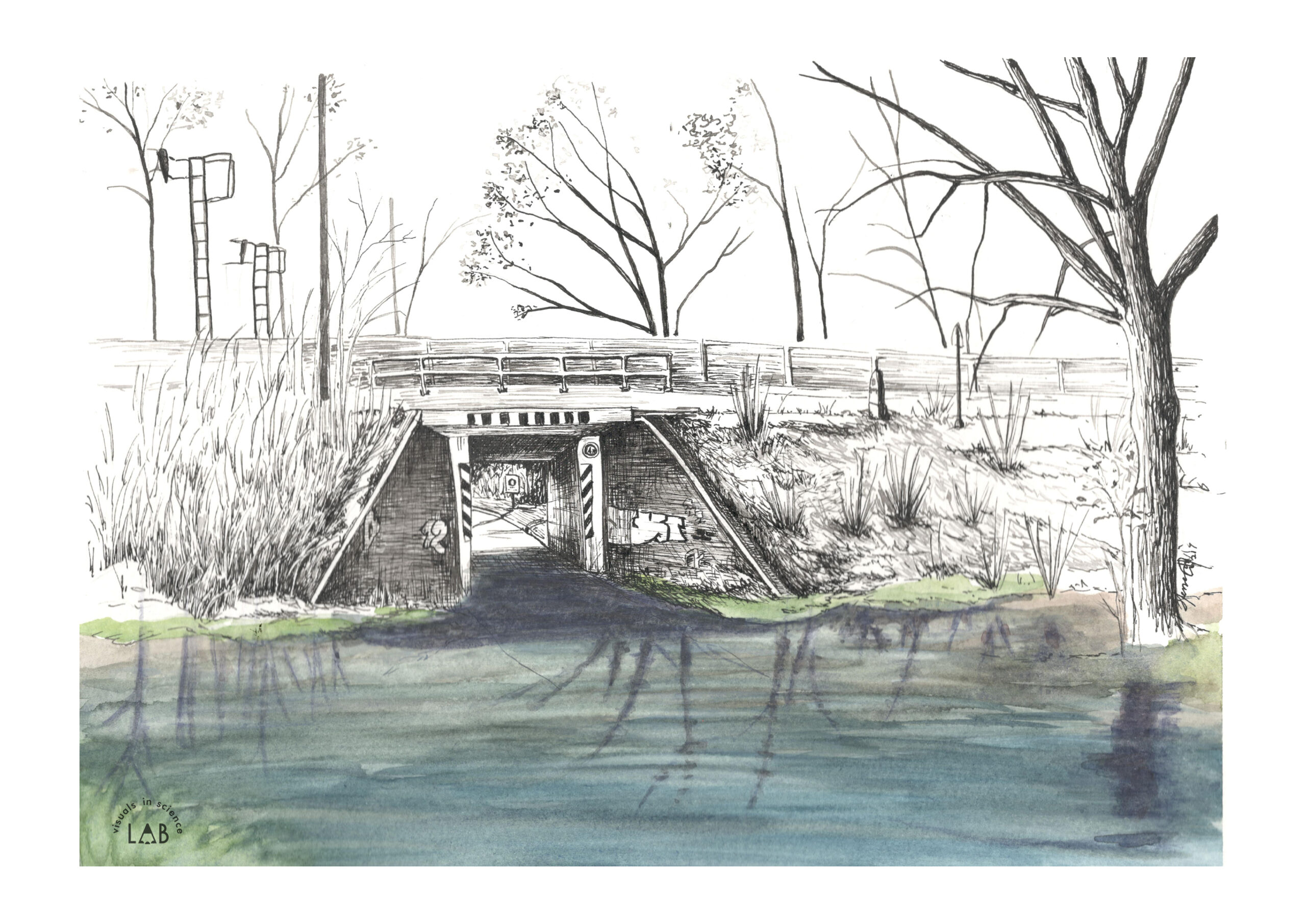
Before
After
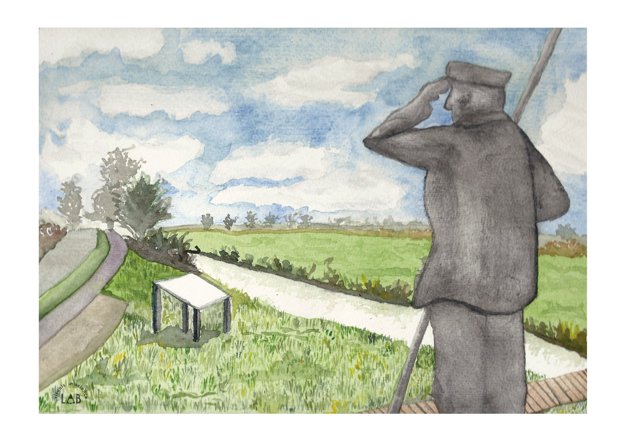
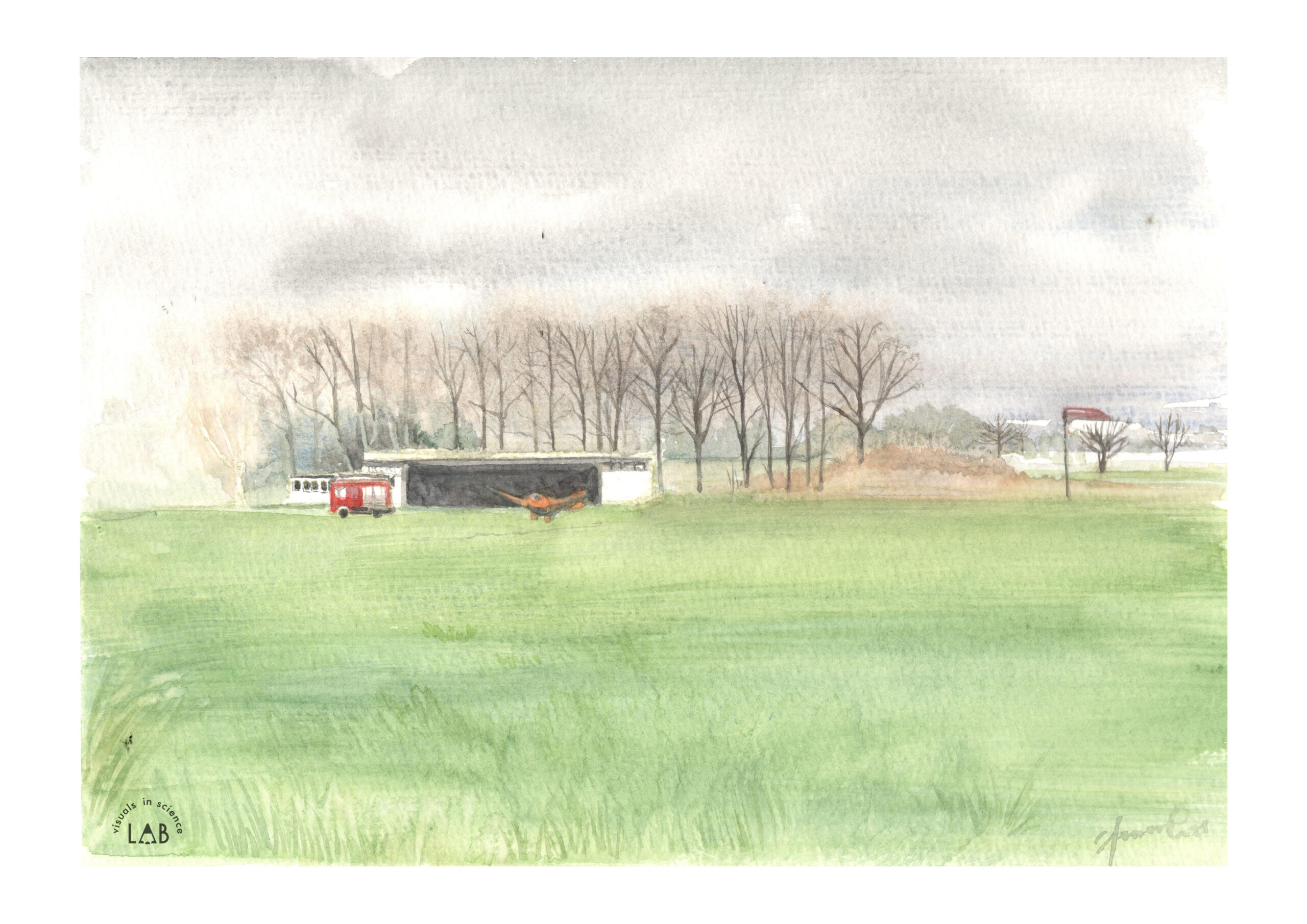
Before
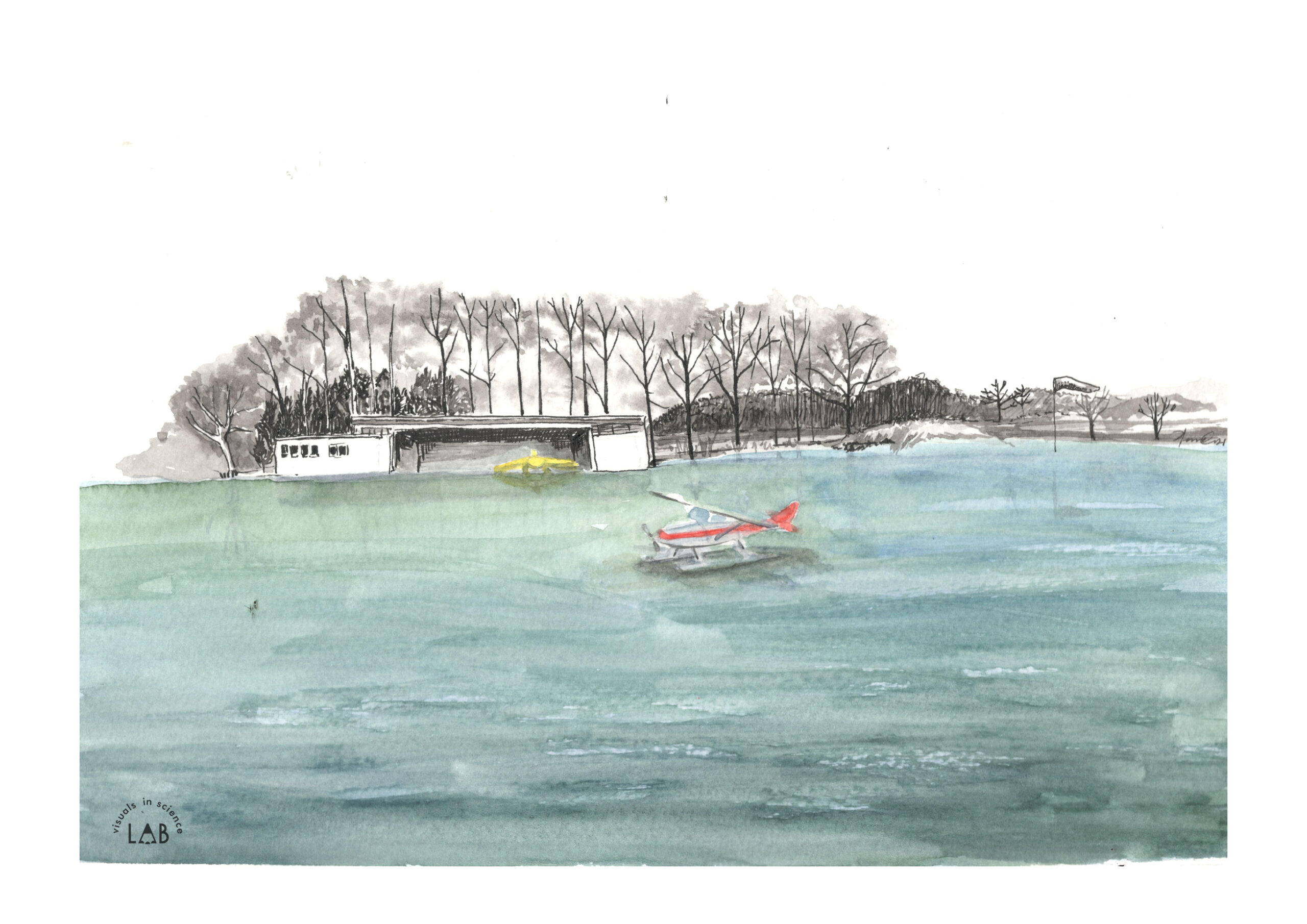
After
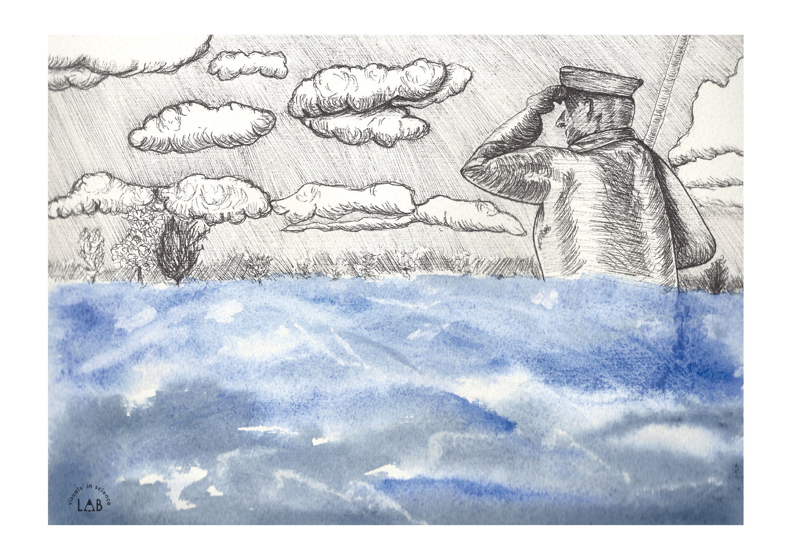
Before
After
Before
After
Before
After
An introductory blog to this project can be found here
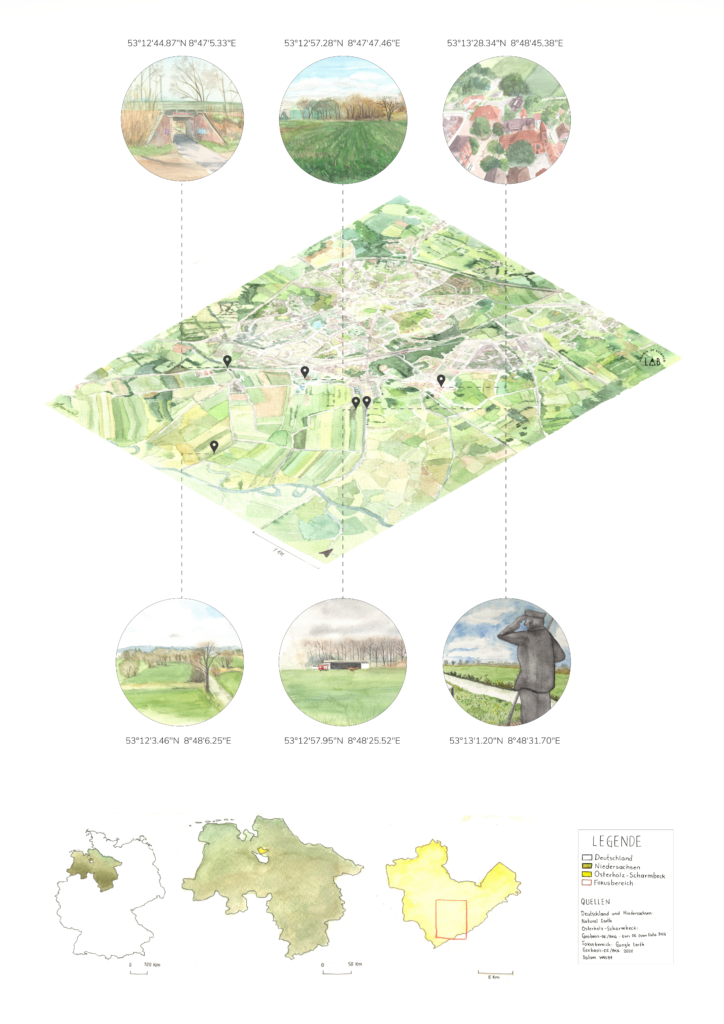
Osterholz-Scharmbeck might not be as glamorous as Barcelona [1], or cosmopolitan as New York [2] but it is also a place where people live and develop their livelihoods. And it is a place that is very likely to change in the coming decades. What will this change look like? It depends on many and complicated factors (global changes, local changes, and social actions taken). For now, we have focused on the 1-meter sea-level rise. This is when science meets art to tell us about possible future realities.
Saying this we invite you to travel to Osterholz in the future.
Since the beginning of history, humans have faced climate risks. The settlement of the Osterholz Geest (North German coastal heathland) can easily be explained by geological and ecological factors. The slightly elevated sandy soils offered protection from coastal floods that could affect the Weser (River in northwest Germany) and the coastal marshes. Therefore, it is not a coincidence that the St. Marien Monastery Church (Marienkloster) was built directly on the border between Geest and Marsch (Marsch refers to the typical landscape and at the German North Sea coast) in 1186. Nowadays, the old Monastery still gives its name to the city area “Osterholz”. City historians related the name “Osterholz” (Eastern Wood) with the sparse tree cover in the region at that time. From the feud Lesum, it could be seen as a woody area to the east, which provided important raw materials.
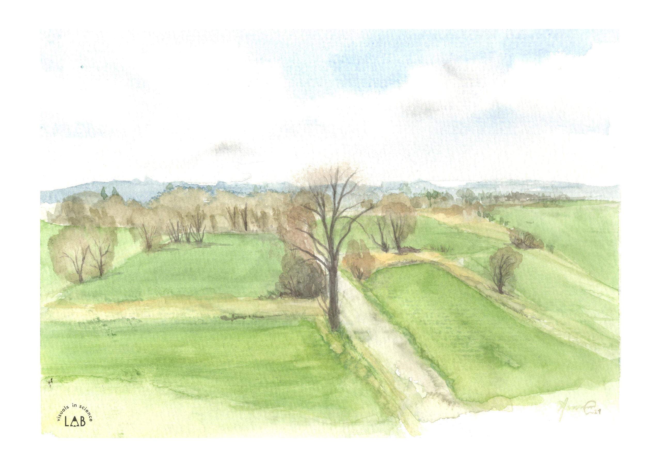
The Osterholz Geest is characterized by a long history of settlements. On the west, the Osterholz Geest adjoins the Hamme lowlands, a natural protected area, full of wet marshes and bog soils (‘Teufelsmoor’). Although geest soils are mostly sandy and relatively infertile for agriculture, they are good for pasture farming. Similarly, bog soils are also unsuitable for agriculture and forest growth. Furthermore, bogs make road construction and traffic difficult.
For centuries people have benefited from the Moor and Marsch. The neighboring Bremen has increased its population from 20,000 inhabitants in 1350 up to 160,000 in 1900. During the 20th century, the Bremen population has tripled, while the city of Osterholz-Scharmbeck has grown six-fold, due to the attractive location near the big city.
The harbor was part of the development plan of the Teufelsmoor-region. Building drainage ditches and peat digging turned the low areas attractive for livestock farming. From 1765 on, the harbor served as an important place to transport manufactured goods and construction materials. From this harbor, steamboats were exported overseas. However, with the decline of the industry at the beginning of the last century, and the expansion of roads, the harbor has lost its economic importance and nowadays is used mostly for recreational activities.
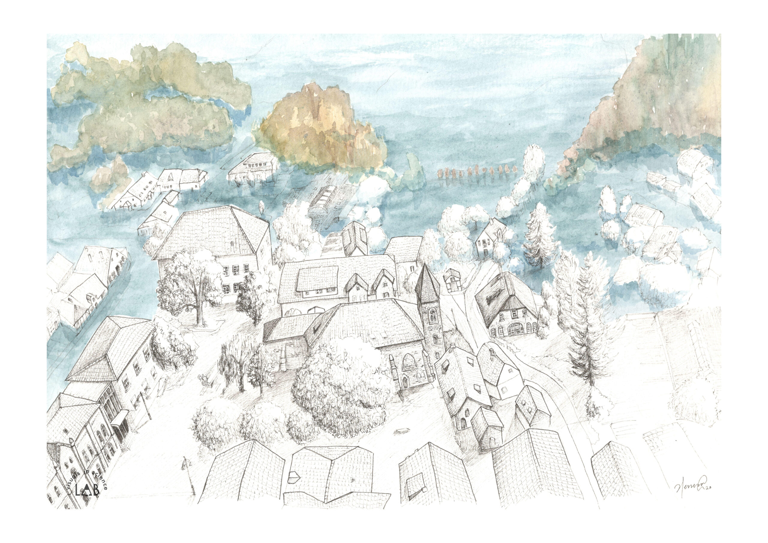
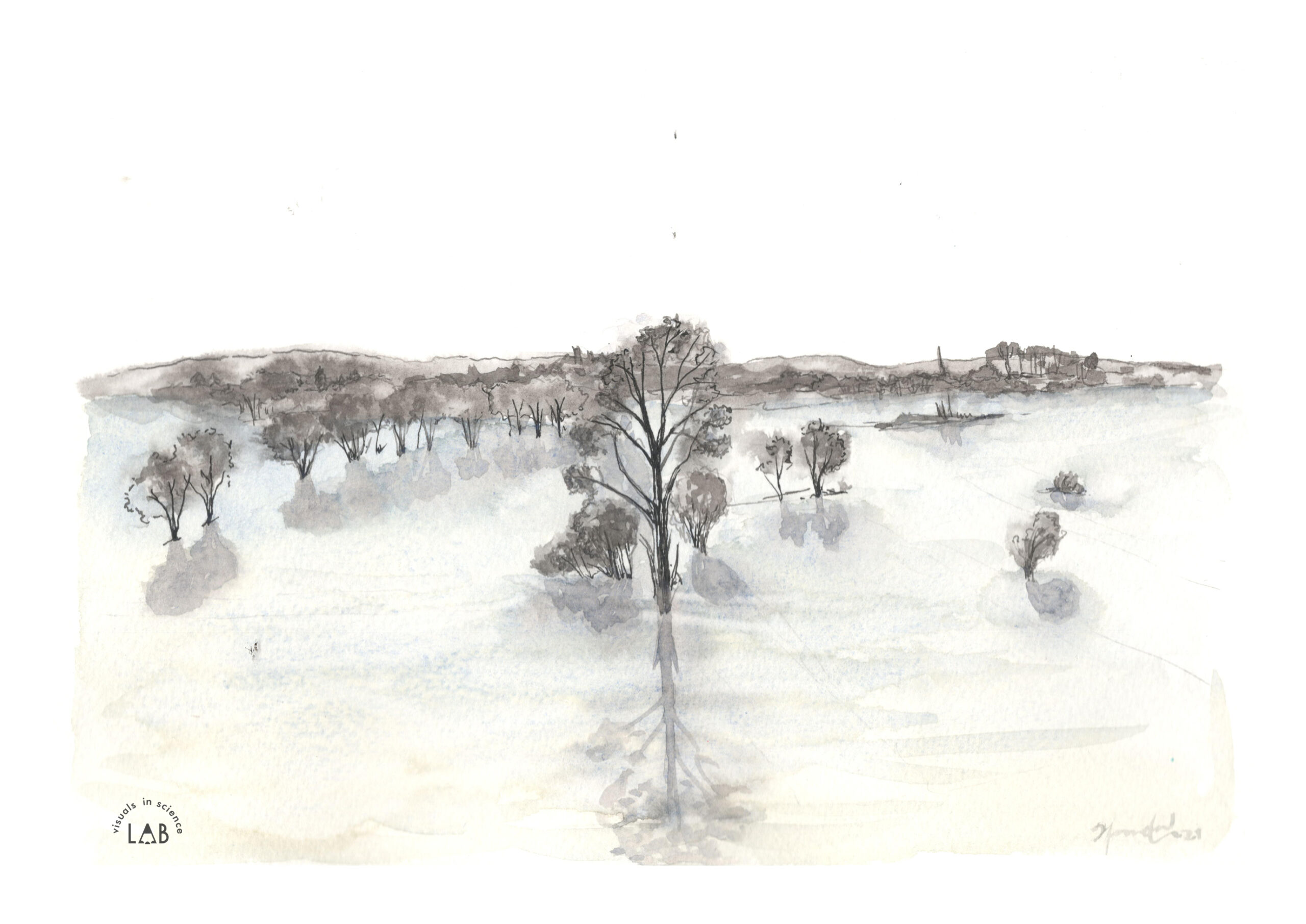
Climate projections show that it is only a matter of time that storm surges and tide rises become a threat to the Marsch. If we leave an ice cube in a room, we are sure about what will happen: it will melt! But how long it takes, will depend on several factors (i.e., room temperature, humidity, wind, construction materials, outside climatic conditions, size of the room), which are difficult to determine. Something similar occurs with the global climate system. Even by limiting the warming effect by only two degrees, we know that eventually, the sea level will keep rising for centuries to come.
By the end of the 21st century, it is expected that the sea-level increases by around 1 meter [4][5]. Already, nowadays, dykes are strengthened and heightened. The occurrence of the so-called “century floods” (floods occurring once every three years) will triple. A further increase in sea levels (2 to 3 meters) is expected in the coming century. No one can predict exactly when this will happen, but, there will be a day when the dykes are overcome due to sea levels rising.
Scientists suggest scenarios of future coastal protection infrastructure, varying from “hard” infrastructure to “soft”. It is expected that the hard constructions [6] such as dykes will not be able to resist. Their extreme costs are exemplified by the suggestion to build a wall with pumps from Scotland to Norway [7]. Therefore, scientists argue that it is more reasonable to rely on ‘soft’ natural coastal protection. One scenario, is, for example, to substitute the coastal protection provided by the dykes, with a designated floodplain. This alternative would give more time before Bremen is covered by water but would turn today’s marshes and bog into a Bodden: half salty, half sweet, cut off from the sea by permeable dykes.
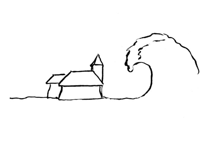
Thus, at its 1000th anniversary, the St. Marie Monastery will very likely stand at sea level and some lower-lying buildings will have been either destroyed by catastrophes because no preventive action was taken or will have been deliberately relocated.
The harbor on the other hand, for its 500th anniversary, will shine more than ever. It will have regained its economic importance for people and goods trading. Excursion boats, Dutch flatboats, introduced by refugees, set off excursions to bird and seal banks. And the Weserbodden will be a popular destination for windsurfers and sea paddlers and tourists will enjoy sunbathing on the Geest beaches.
This project was developed by Visuals in Science LAB in cooperation with Dr. Christian Bunn.
Illustrations for the current scenario were done on the place, while the illustrations for the future scenario were based on the Coastal Risk screening tool projection (by Climate Central) Climate Central | Land projected to be below annual flood level in 2050. Visited on 18.08.2020.
We are thankful to Ulrike Chantelau for her help with logistic and localization details on site; and to Alexander Giebler and Frederike Gröner for their comments on the text.
| Cookie | Duration | Description |
|---|---|---|
| _ga | 2 years | The _ga cookie, installed by Google Analytics, calculates visitor, session and campaign data and also keeps track of site usage for the site's analytics report. The cookie stores information anonymously and assigns a randomly generated number to recognize unique visitors. |
| _ga_FFMJDQW0TN | 2 years | This cookie is installed by Google Analytics. |
| Cookie | Duration | Description |
|---|---|---|
| bWLYKBGaHqfPTFS | 1 day | No description |
| RbVnUGJAdM | 1 day | No description |